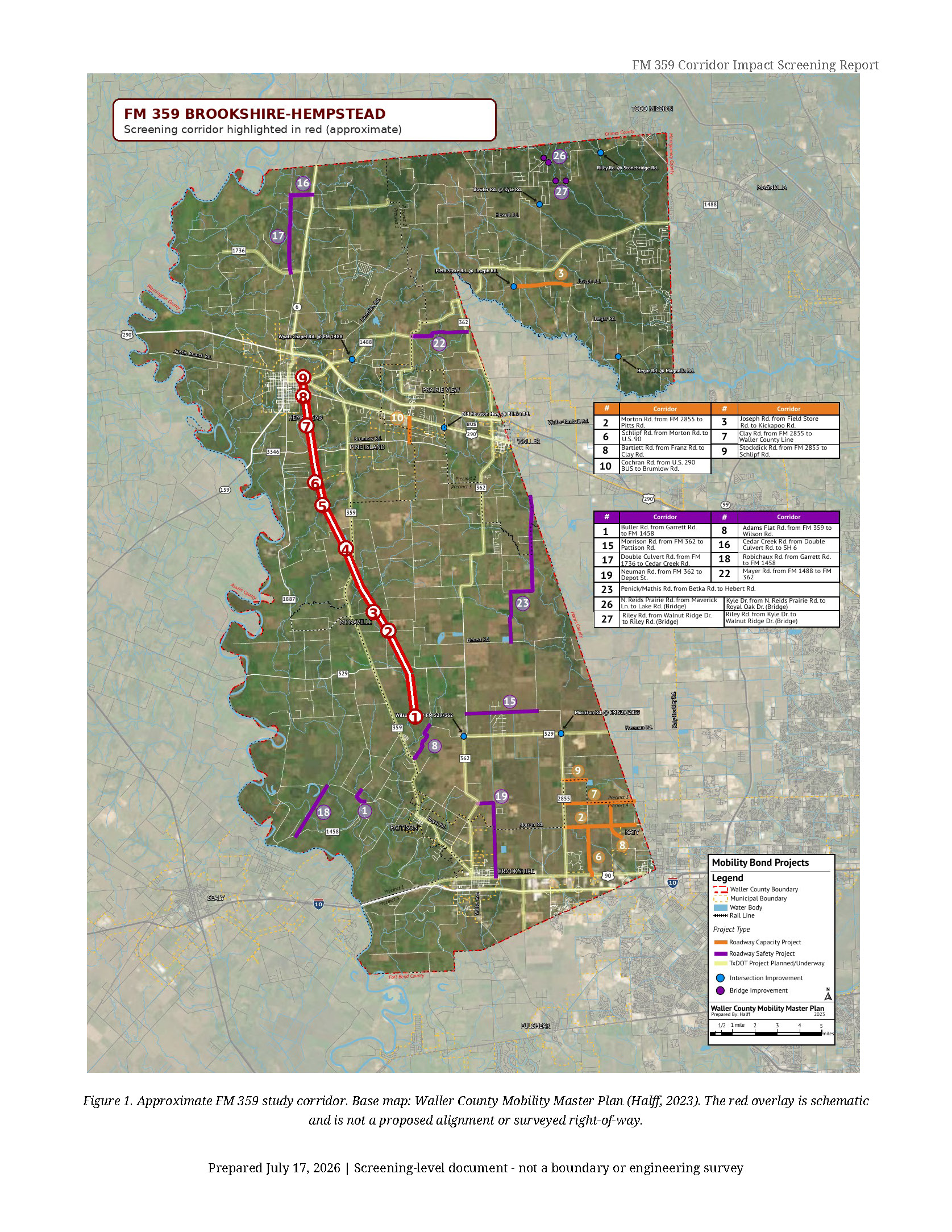
An annotated FM 359 corridor map from Brookshire to Hempstead
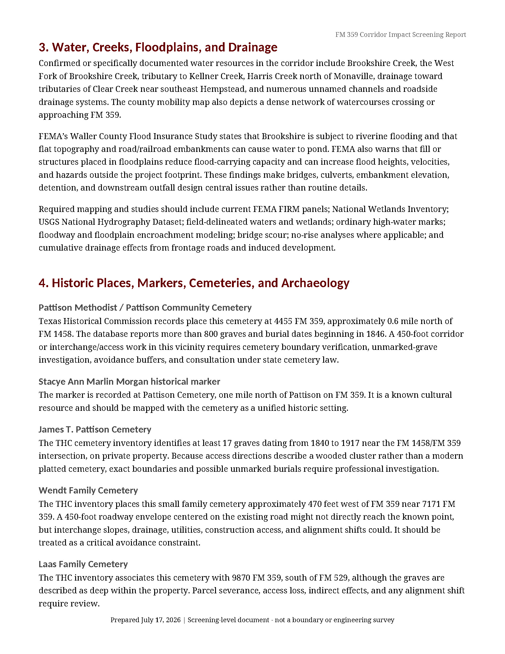
Creeks, drainage systems, floodplain concerns, and named water crossings
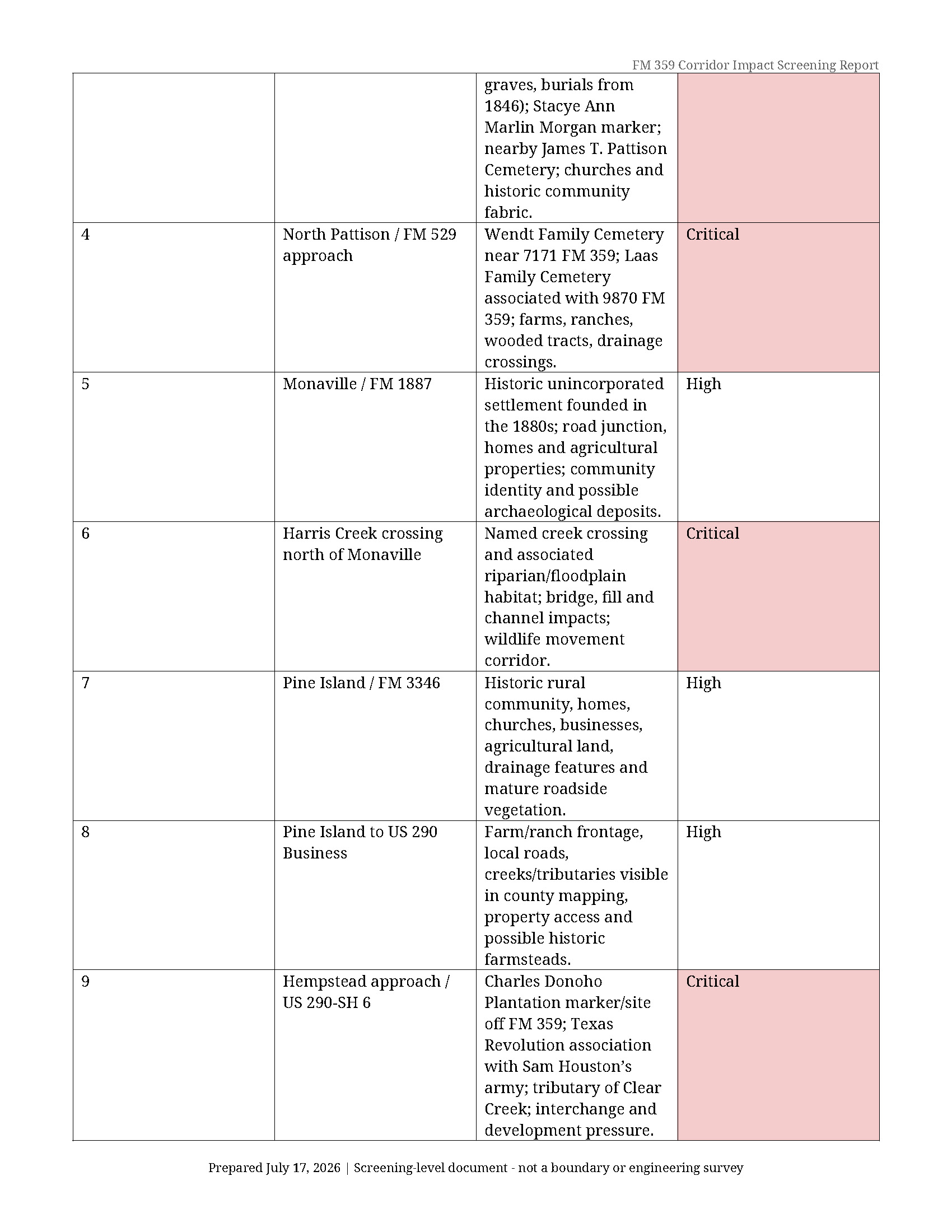
Known cemeteries and historical resources along or near FM 359
The Charles Donoho Plantation and Sam Houston’s 1836 encampment area
Pattison, Monaville, Pine Island, Brookshire, and Hempstead community impacts
Agricultural, ranching, wildlife, property-access, and quality-of-life concerns
A list of environmental studies and government records that should be demanded
Preliminary avoidance recommendations
A field-verification checklist
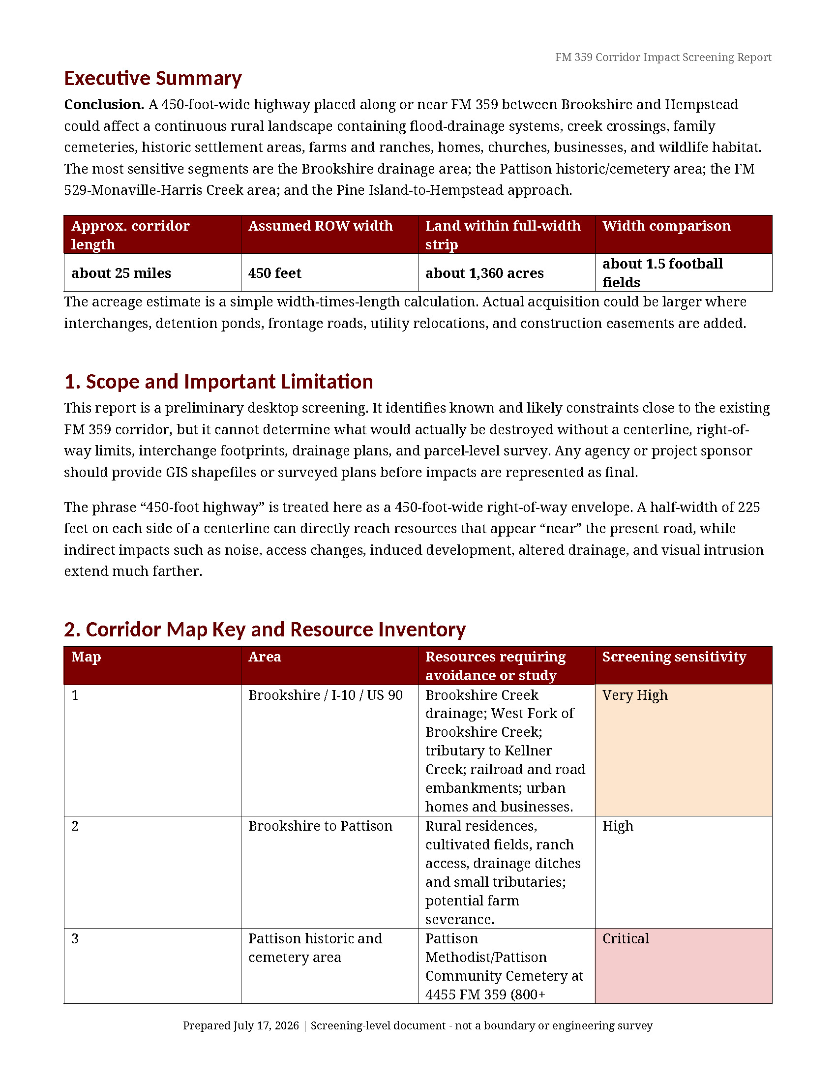
The red corridor shown on the map is approximate, because an official proposed centerline and right-of-way map have not yet been provided. The report estimates that a continuous 450-foot-wide corridor over approximately 25 miles could encompass roughly 1,360 acres, before adding interchanges, detention ponds, frontage roads, utilities, or construction easements.